
From glacial melt to forest fires, polluted rivers to penguin migration patterns, students investigate satellite data to discover how the natural world is adapting.
Their work contributes to scientists’ efforts to understand our changing landscape.
Project timeline
Earth Observation follows IRIS’ 4 phased project structure:
Prepare & launch: Teachers prepare and launch the project, using our helpful guidance documents.
Background research & skills development:
With access to our support materials, students develop the knowledge and skills required to successfully complete research.
Student research: Young scientists systematically investigate, explore, discover, analyse and establish their conclusions.
Artefact development and conference: Students produce an article, academic poster presentation or academic paper, based on their research process and/or findings with the aim of exhibiting at IRIS’ conference.
Overview
Moderate
suitability
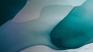

The Earth is encircled by a cluster of satellites, many of which look back towards our planet, gathering data and monitoring changes.
The aim of this project is to encourage students to recognise the wealth of data available to them through satellite images and learn how to use this information.
Earth Observation challenges budding scientists to look at the information collected across a range of wavelengths and processes and to investigate how this might change over time and the localised impact of such change.
Before they embark in their studies, students will learn more about the different types of satellite and how the images are gathered. This allows them to understand how to use these images to gather as much data as possible.
This project is suitable for students studying geography, as well as the sciences, and it engages students across the curriculum.
We collect evidence to evaluate the impact that our programmes have on schools, teachers, partners and most importantly, on young people.
Take a look at our evaluation reports.